
Südliche Innenstadt topographic map
Interactive map
Click on the map to display elevation.
About this map
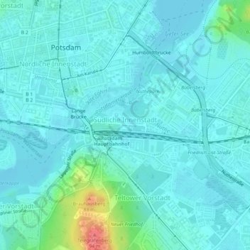
Name: Südliche Innenstadt topographic map, elevation, terrain.
Average elevation: 39 m
Minimum elevation: 29 m
Maximum elevation: 96 m
Other topographic maps
Click on a map to view its topography, its elevation and its terrain.
Brandenburger Vorstadt
Alemanha > Brandemburgo > Potsdam > Auf dem Kiewitt
Brandenburger Vorstadt, Westliche Vorstädte, Auf dem Kiewitt, Potsdam, Brandemburgo, 14471, Alemanha
Average elevation: 38 m