
Svätý Anton topographic map
Interactive map
Click on the map to display elevation.
About this map
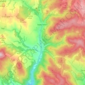
Name: Svätý Anton topographic map, elevation, terrain.
Average elevation: 551 m
Minimum elevation: 341 m
Maximum elevation: 747 m
Other topographic maps
Click on a map to view its topography, its elevation and its terrain.
Močiar
Slovakia > Region of Banská Bystrica > District of Banská Štiavnica > Močiar
Močiar, District of Banská Štiavnica, Region of Banská Bystrica, Central Slovakia, Slovakia
Average elevation: 608 m
Banská Štiavnica
Slovakia > Region of Banská Bystrica > District of Banská Štiavnica
Banská Štiavnica, District of Banská Štiavnica, Region of Banská Bystrica, Central Slovakia, 969 01, Slovakia
Average elevation: 622 m