
Santa Águeda / Agate Deuna topographic map
Interactive map
Click on the map to display elevation.
About this map
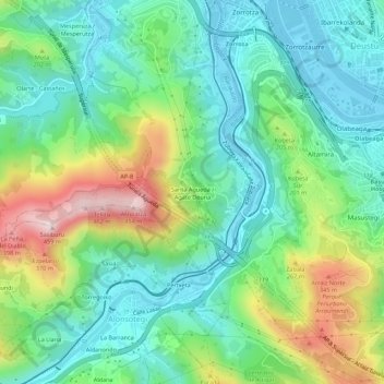
Name: Santa Águeda / Agate Deuna topographic map, elevation, terrain.
Average elevation: 134 m
Minimum elevation: -2 m
Maximum elevation: 438 m
Other topographic maps
Click on a map to view its topography, its elevation and its terrain.
Tellitu
España > País Vasco > Baracaldo > Tellitu
Tellitu, Baracaldo, Vizcaya, País Vasco, 48093, España
Average elevation: 263 m