
Thank you for supporting this site ❤️
Make a donation
Make a donation
Brookeville topographic map
Click on the map to display elevation.
Thank you for supporting this site ❤️
Make a donation
Make a donation
About this map
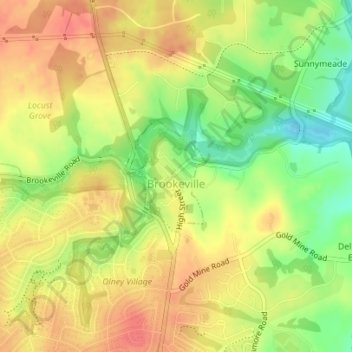
Name: Brookeville topographic map, elevation, terrain.
Location: Brookeville, Montgomery County, Maryland, United States (39.17658 -77.06335 39.18521 -77.05553)
Average elevation: 129 m
Minimum elevation: 93 m
Maximum elevation: 155 m
Thank you for supporting this site ❤️
Make a donation
Make a donation