
Aïn Djasser topographic map
Interactive map
Click on the map to display elevation.
About this map
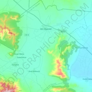
Name: Aïn Djasser topographic map, elevation, terrain.
Location: Aïn Djasser, Aïn Djasser district, Batna, Algeria (35.75705 5.91999 35.90591 6.08354)
Average elevation: 909 m
Minimum elevation: 813 m
Maximum elevation: 1,415 m