
Bad Münstereifel topographic map
Interactive map
Click on the map to display elevation.
About this map
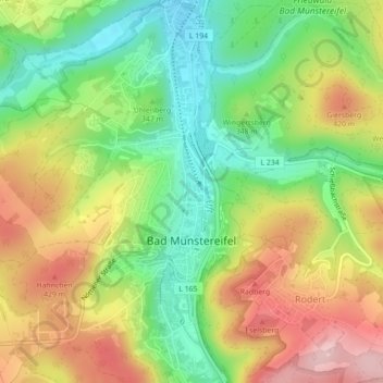
Name: Bad Münstereifel topographic map, elevation, terrain.
Average elevation: 350 m
Minimum elevation: 256 m
Maximum elevation: 461 m
Other topographic maps
Click on a map to view its topography, its elevation and its terrain.
Arloff
Duitsland > Noordrijn-Westfalen > Bad Münstereifel > Arloff
Arloff, Bad Münstereifel, Kreis Euskirchen, Noordrijn-Westfalen, Duitsland
Average elevation: 246 m