
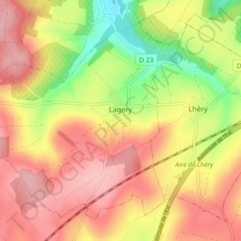
Lagery topographic map
Interactive map
Click on the map to display elevation.
About this map
Name: Lagery topographic map, elevation, terrain.
Average elevation: 189 m
Minimum elevation: 103 m
Maximum elevation: 250 m
Other topographic maps
Click on a map to view its topography, its elevation and its terrain.
Courtisols
Courtisols, Châlons-en-Champagne, Marne, Grand Est, France métropolitaine, 51460, France
Average elevation: 154 m
Mont Saint-Pierre
France > Grand Est > Marne > Champigny
Mont Saint-Pierre, Champigny, Reims, Marne, Grand Est, France métropolitaine, 51370, France
Average elevation: 86 m
Saint-Gilles
Saint-Gilles, Reims, Marne, Grand Est, France métropolitaine, 51170, France
Average elevation: 118 m
Belle Feuille
France > Grand Est > Marne > Aÿ-Champagne
Belle Feuille, Bisseuil, Aÿ-Champagne, Épernay, Marne, Grand Est, France métropolitaine, 51150, France
Average elevation: 132 m