
Thank you for supporting this site ❤️
Make a donation
Make a donation
Songbei District topographic map
Click on the map to display elevation.
Thank you for supporting this site ❤️
Make a donation
Make a donation
About this map
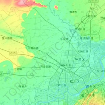
Name: Songbei District topographic map, elevation, terrain.
Location: Songbei District, Harbin, Heilongjiang, 150000, China (45.73067 126.16344 46.09339 126.71066)
Average elevation: 127 m
Minimum elevation: 112 m
Maximum elevation: 196 m
Thank you for supporting this site ❤️
Make a donation
Make a donation