
Thank you for supporting this site ❤️
Make a donation
Make a donation
Gatwekera topographic map
Click on the map to display elevation.
Thank you for supporting this site ❤️
Make a donation
Make a donation
About this map
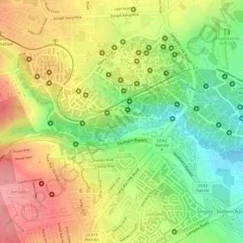
Name: Gatwekera topographic map, elevation, terrain.
Location: Gatwekera, Nairobi County, Kenya (-1.31763 36.77844 -1.31327 36.78869)
Average elevation: 1,744 m
Minimum elevation: 1,681 m
Maximum elevation: 1,800 m
Thank you for supporting this site ❤️
Make a donation
Make a donation
Other topographic maps
Click on a map to view its topography, its elevation and its terrain.