
Thank you for supporting this site ❤️
Make a donation
Make a donation
Saba Island topographic map
Click on the map to display elevation.
Thank you for supporting this site ❤️
Make a donation
Make a donation
About this map
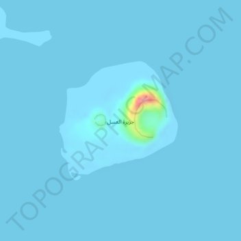
Name: Saba Island topographic map, elevation, terrain.
Location: Saba Island, Kamaran District, Al Hudaydah Governorate, Yemen (15.07769 42.14570 15.09106 42.15947)
Average elevation: 2 m
Minimum elevation: -2 m
Maximum elevation: 107 m
Thank you for supporting this site ❤️
Make a donation
Make a donation
Other topographic maps
Click on a map to view its topography, its elevation and its terrain.
Hodeidah
Yemen > Al Hudaydah Governorate
Mountain Highlands: Notable mountains include Jabal Ras and Jabal Bura, both reaching elevations of 2,000 to 2,400 meters above sea level.
Average elevation: 16 m