
Lloyd District topographic map
Interactive map
Click on the map to display elevation.
About this map
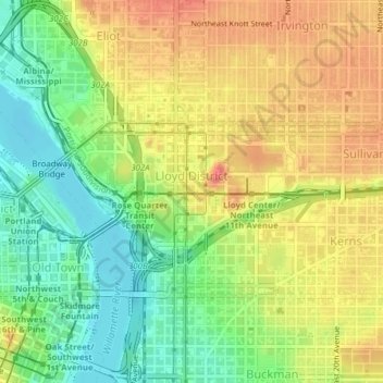
Name: Lloyd District topographic map, elevation, terrain.
Average elevation: 34 m
Minimum elevation: 3 m
Maximum elevation: 64 m
Other topographic maps
Click on a map to view its topography, its elevation and its terrain.
Portland
Vereinigte Staaten von Amerika > Oregon > Portland
Portland, Multnomah County, Oregon, Vereinigte Staaten von Amerika
Average elevation: 77 m