
Make a donation
Dasmariñas topographic map
Click on the map to display elevation.
Make a donation
Dasmariñas
Dasmariñas is partly lowland and partly hilly. The Poblacion itself is elevated. From an elevation of 80 meters (260 ft) at the Poblacion, the land rises to 250 meters (820 ft) towards Silang. Generally, land near rivers and creeks are rugged. Dasmariñas is outside the typhoon belt and has no fault line constraints. Further, it is served by natural drainage system since it is traversed by several rivers and water tributaries draining to the Manila Bay. The city has not yet to experience floods.
Make a donation
About this map
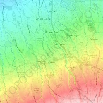
Name: Dasmariñas topographic map, elevation, terrain.
Location: Dasmariñas, Cavite, Calabarzon, Philippines (14.24820 120.92052 14.36373 121.01164)
Average elevation: 125 m
Minimum elevation: 28 m
Maximum elevation: 269 m
Make a donation
Other topographic maps
Click on a map to view its topography, its elevation and its terrain.