
Île Anselme-Fay topographic map
Interactive map
Click on the map to display elevation.
About this map
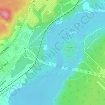
Name: Île Anselme-Fay topographic map, elevation, terrain.
Location: Île Anselme-Fay, Shawinigan, Mauricie, Québec, Canada (46.57231 -72.70812 46.57504 -72.70558)
Average elevation: 105 m
Minimum elevation: 75 m
Maximum elevation: 200 m