
球溪镇 topographic map
Interactive map
Click on the map to display elevation.
About this map
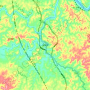
Name: 球溪镇 topographic map, elevation, terrain.
Location: 球溪镇, 内江市, 四川省, 中国 (29.87169 104.58296 29.95169 104.66296)
Average elevation: 383 m
Minimum elevation: 325 m
Maximum elevation: 465 m
Other topographic maps
Click on a map to view its topography, its elevation and its terrain.