
Cameron Highlands topographic map
Interactive map
Click on the map to display elevation.
About this map
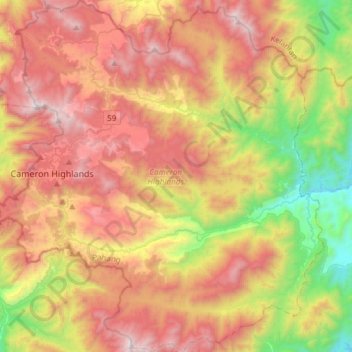
Name: Cameron Highlands topographic map, elevation, terrain.
Location: Cameron Highlands, Pahang, Malaisie (4.32139 101.33159 4.61839 101.60792)
Average elevation: 1,117 m
Minimum elevation: 172 m
Maximum elevation: 2,066 m
Le district compte huit localités (dont le centre administratif Tanah Rata (en)) situées à des altitudes comprises entre 800 et 1 600 mètres d'altitude. Au nord, sa limite touche Kelantan ; à l'ouest, il partage une partie de sa frontière avec le Perak.