
Carlisle Island topographic map
Interactive map
Click on the map to display elevation.
About this map
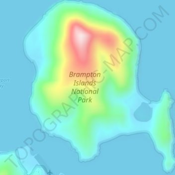
Name: Carlisle Island topographic map, elevation, terrain.
Location: Carlisle Island, Mackay, Queensland, Australien (-20.80509 149.27487 -20.77550 149.30336)
Average elevation: 64 m
Minimum elevation: 0 m
Maximum elevation: 380 m
Other topographic maps
Click on a map to view its topography, its elevation and its terrain.
Mount McBride
Australien > Queensland > Mackay
Mount McBride, Mackay, Queensland, Australien
Average elevation: 296 m