
Gile topographic map
Interactive map
Click on the map to display elevation.
About this map
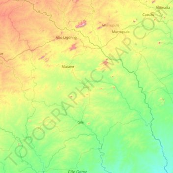
Name: Gile topographic map, elevation, terrain.
Location: Gile, Provinz Zambezia, Mosambik (-16.52618 37.80800 -15.23363 38.94106)
Average elevation: 311 m
Minimum elevation: 30 m
Maximum elevation: 1,219 m
Other topographic maps
Click on a map to view its topography, its elevation and its terrain.