
Thank you for supporting this site ❤️
Make a donation
Make a donation
Jacobsdorf topographic map
Click on the map to display elevation.
Thank you for supporting this site ❤️
Make a donation
Make a donation
About this map
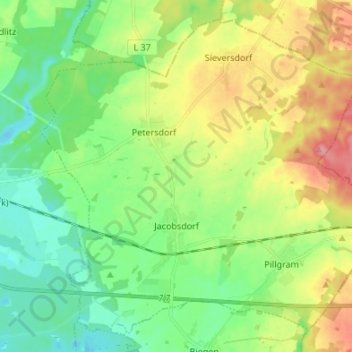
Name: Jacobsdorf topographic map, elevation, terrain.
Location: Jacobsdorf, Odervorland, Oder-Spree, Brandenburg, Deutschland (52.31384 14.30141 52.38749 14.43633)
Average elevation: 70 m
Minimum elevation: 38 m
Maximum elevation: 125 m
Thank you for supporting this site ❤️
Make a donation
Make a donation