
Thisted topographic map
Interactive map
Click on the map to display elevation.
About this map
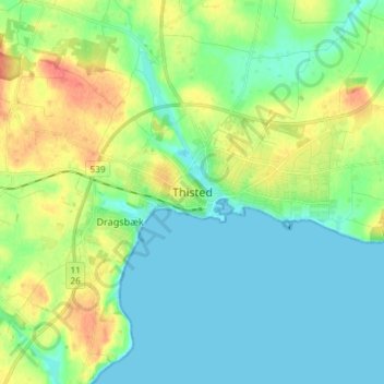
Name: Thisted topographic map, elevation, terrain.
Location: Thisted, Thisted Kommune, Jutland du Nord, Danemark (56.91621 8.64487 56.99621 8.72487)
Average elevation: 17 m
Minimum elevation: -2 m
Maximum elevation: 55 m