
Citadel topographic map
Interactive map
Click on the map to display elevation.
About this map
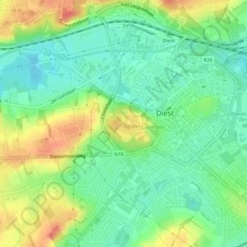
Name: Citadel topographic map, elevation, terrain.
Location: Citadel, Diest, Löwen, Flämisch-Brabant, 3290, Belgien (50.98172 5.04243 50.98482 5.04701)
Average elevation: 32 m
Minimum elevation: 11 m
Maximum elevation: 64 m