
Thank you for supporting this site ❤️
Make a donation
Make a donation
Shalman topographic map
Click on the map to display elevation.
Thank you for supporting this site ❤️
Make a donation
Make a donation
About this map
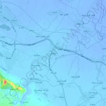
Name: Shalman topographic map, elevation, terrain.
Location: Shalman, دهستان دریاسر, بخش کومله, Langarud County, Iran (37.11592 50.17619 37.19592 50.25619)
Average elevation: -14 m
Minimum elevation: -27 m
Maximum elevation: 108 m
Thank you for supporting this site ❤️
Make a donation
Make a donation