
Thank you for supporting this site ❤️
Make a donation
Make a donation
Mincy topographic map
Click on the map to display elevation.
Thank you for supporting this site ❤️
Make a donation
Make a donation
About this map
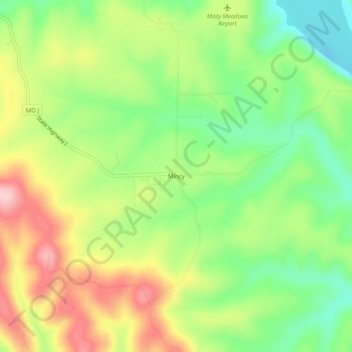
Name: Mincy topographic map, elevation, terrain.
Location: Mincy, Taney County, Missouri, 67679, United States (36.54423 -93.13018 36.58423 -93.09018)
Average elevation: 278 m
Minimum elevation: 186 m
Maximum elevation: 394 m
Thank you for supporting this site ❤️
Make a donation
Make a donation
Other topographic maps
Click on a map to view its topography, its elevation and its terrain.