
Porto Mourisco topographic map
Interactive map
Click on the map to display elevation.
About this map
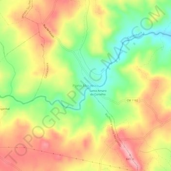
Name: Porto Mourisco topographic map, elevation, terrain.
Location: Porto Mourisco, Guarda, 6320-131, Portugal (40.52051 -7.09837 40.56051 -7.05837)
Average elevation: 774 m
Minimum elevation: 692 m
Maximum elevation: 850 m