
Sulztal topographic map
Interactive map
Click on the map to display elevation.
About this map
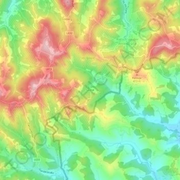
Name: Sulztal topographic map, elevation, terrain.
Average elevation: 399 m
Minimum elevation: 297 m
Maximum elevation: 521 m
Other topographic maps
Click on a map to view its topography, its elevation and its terrain.
Eckberg
Österreich > Steiermark > Bezirk Leibnitz > Gamlitz
Eckberg, Gamlitz, Bezirk Leibnitz, Steiermark, 8462, Österreich
Average elevation: 401 m