
Teuchitlán topographic map
Interactive map
Click on the map to display elevation.
About this map
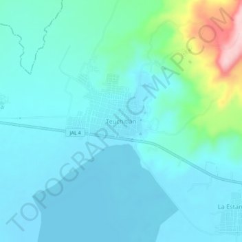
Name: Teuchitlán topographic map, elevation, terrain.
Location: Teuchitlán, Region Valles, Jalisco, 46760, México (20.66372 -103.86727 20.70372 -103.82727)
Average elevation: 1,293 m
Minimum elevation: 1,255 m
Maximum elevation: 1,490 m
Other topographic maps
Click on a map to view its topography, its elevation and its terrain.
El Amarillo
México > Jalisco > Teuchitlán
El Amarillo, Teuchitlán, Region Valles, Jalisco, 46763, México
Average elevation: 1,291 m