Geolocate

طينة topographic map

Interactive map

Click on the map to display elevation.

About this map

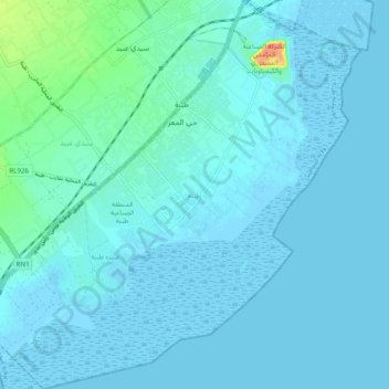
Name: طينة topographic map, elevation, terrain.

Location: طينة, معتمدية طينة, Sfax, Tunisia (34.62901 10.65589 34.70952 10.75282)

Average elevation: 5 m

Minimum elevation: -4 m

Maximum elevation: 51 m

Other topographic maps

Click on a map to view its topography, its elevation and its terrain.

‫السمارة‬

Tunisia > Sfax

‫السمارة‬, معتمدية ‫المحرس‬, Sfax, Tunisia

Average elevation: 13 m

سكرة

Tunisia > Sfax > معتمدية صفاقس الغربية

سكرة, معتمدية صفاقس الغربية, Sfax, 3003, Tunisia

Average elevation: 6 m

Sfax

Tunisia > Sfax > Sfax

Sfax, Rue Amilcar, صفاقس الجديدة, Sfax, المدينة, صفاقس المدينة, Sfax, 3000, Tunisia

Average elevation: 16 m

‫الصخیرة‬

Tunisia > Sfax

‫الصخیرة‬, Sfax, Tunisia

Average elevation: 50 m