
Villarlurin topographic map
Interactive map
Click on the map to display elevation.
About this map
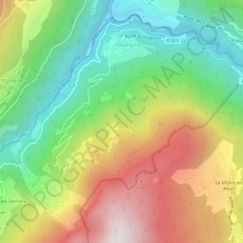
Name: Villarlurin topographic map, elevation, terrain.
Average elevation: 1,022 m
Minimum elevation: 504 m
Maximum elevation: 1,729 m
Other topographic maps
Click on a map to view its topography, its elevation and its terrain.
l'Etelé
Frankrijk > Auvergne-Rhône-Alpes > Savoie > Les Belleville
l'Etelé, Saint-Martin-de-Belleville, Les Belleville, Albertville, Savoie, Auvergne-Rhône-Alpes, Metropolitaans Frankrijk, 73440, Frankrijk
Average elevation: 2,134 m
Caseblanche
Frankrijk > Auvergne-Rhône-Alpes > Savoie > Les Belleville > Caseblanche
Caseblanche, Saint-Martin-de-Belleville, Les Belleville, Albertville, Savoie, Auvergne-Rhône-Alpes, Metropolitaans Frankrijk, 73440, Frankrijk
Average elevation: 1,637 m