
Walchwil topographic map
Interactive map
Click on the map to display elevation.
About this map
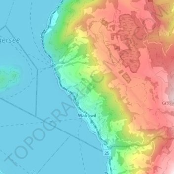
Name: Walchwil topographic map, elevation, terrain.
Location: Walchwil, Zug, 6318, Schweiz (47.08986 8.49304 47.12761 8.56634)
Average elevation: 654 m
Minimum elevation: 407 m
Maximum elevation: 1,165 m