
Thank you for supporting this site ❤️
Make a donation
Make a donation
Margretenhaun topographic map
Click on the map to display elevation.
Thank you for supporting this site ❤️
Make a donation
Make a donation
About this map
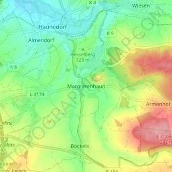
Name: Margretenhaun topographic map, elevation, terrain.
Location: Margretenhaun, Petersberg, Landkreis Fulda, Hessen, Deutschland (50.54594 9.74206 50.58594 9.78206)
Average elevation: 329 m
Minimum elevation: 284 m
Maximum elevation: 398 m
Thank you for supporting this site ❤️
Make a donation
Make a donation