
Kava topographic map
Interactive map
Click on the map to display elevation.
About this map
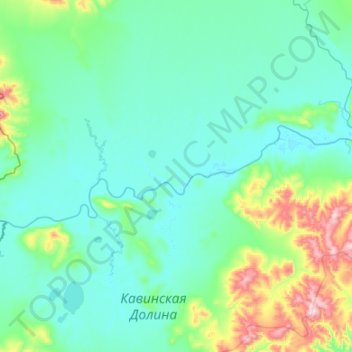
Name: Kava topographic map, elevation, terrain.
Average elevation: 140 m
Minimum elevation: 32 m
Maximum elevation: 965 m
Other topographic maps
Click on a map to view its topography, its elevation and its terrain.
Severo-Evensky Urban District
Severo-Evensky Urban District, Magadan Oblast, Far Eastern Federal District, Russia
Average elevation: 469 m