
Thank you for supporting this site ❤️
Make a donation
Make a donation
Ida County topographic map
Click on the map to display elevation.
Thank you for supporting this site ❤️
Make a donation
Make a donation
About this map
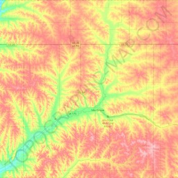
Name: Ida County topographic map, elevation, terrain.
Location: Ida County, Iowa, United States (42.21073 -95.74183 42.56189 -95.32234)
Average elevation: 415 m
Minimum elevation: 343 m
Maximum elevation: 472 m
Thank you for supporting this site ❤️
Make a donation
Make a donation
Other topographic maps
Click on a map to view its topography, its elevation and its terrain.