
Freiburg topographic map
Interactive map
Click on the map to display elevation.
About this map
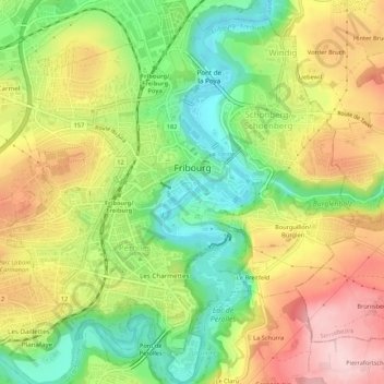
Name: Freiburg topographic map, elevation, terrain.
Location: Freiburg, District de la Sarine, Freiburg, Schweiz (46.78489 7.13565 46.82154 7.18397)
Average elevation: 638 m
Minimum elevation: 528 m
Maximum elevation: 760 m