
Chincholi topographic map
Interactive map
Click on the map to display elevation.
About this map
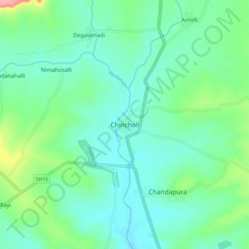
Name: Chincholi topographic map, elevation, terrain.
Average elevation: 466 m
Minimum elevation: 443 m
Maximum elevation: 544 m
Chincholi is located at 17°28′N 77°26′E / 17.47°N 77.43°E / 17.47; 77.43. It has an average elevation of 462 metres (1515 feet). The town is spread over an area of 6 km².
Other topographic maps
Click on a map to view its topography, its elevation and its terrain.
Tumakunta
India > Karnataka > Chincholi taluku > Tumakunta
Tumakunta, Chincholi taluku, Kalaburagi district, Karnataka, 585306, India
Average elevation: 522 m
Chandapura
India > Karnataka > Chincholi taluku
Chandapura, Chincholi taluku, Kalaburagi district, Karnataka, 585307, India
Average elevation: 467 m