
Dillingen topographic map
Interactive map
Click on the map to display elevation.
About this map
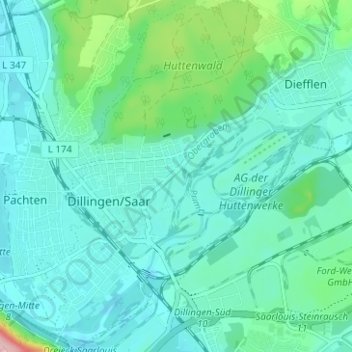
Name: Dillingen topographic map, elevation, terrain.
Average elevation: 201 m
Minimum elevation: 169 m
Maximum elevation: 351 m
Other topographic maps
Click on a map to view its topography, its elevation and its terrain.
66763
Deutschland > Saarland > Landkreis Saarlouis > Dillingen/Saar
66763, Dillingen, Dillingen/Saar, Landkreis Saarlouis, Saarland, Deutschland
Average elevation: 214 m