
Simrishamns kommun topographic map
Interactive map
Click on the map to display elevation.
About this map
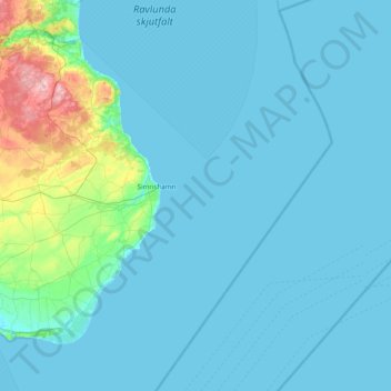
Name: Simrishamns kommun topographic map, elevation, terrain.
Location: Simrishamns kommun, Skåne County, Sweden (55.35221 14.06082 55.76654 14.70173)
Average elevation: 28 m
Minimum elevation: -1 m
Maximum elevation: 188 m
Other topographic maps
Click on a map to view its topography, its elevation and its terrain.
Arlöv
Sweden > Skåne County > Malmo
Arlöv, Malmo, Burlövs kommun, Skåne County, 232 34, Sweden
Average elevation: 8 m