
Aberfoyle topographic map
Click on the map to display elevation.
About this map
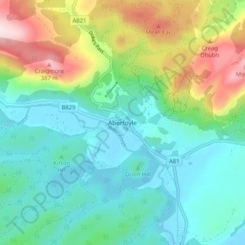
Name: Aberfoyle topographic map, elevation, terrain.
Location: Aberfoyle, Stirling, Scotland, FK8 3UH, United Kingdom (56.15855 -4.40104 56.19855 -4.36104)
Average elevation: 129 m
Minimum elevation: 16 m
Maximum elevation: 416 m
Other topographic maps
Click on a map to view its topography, its elevation and its terrain.