
Aš topographic map
Interactive map
Click on the map to display elevation.
About this map
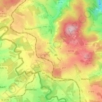
Name: Aš topographic map, elevation, terrain.
Location: Aš, okres Cheb, Regio Karlsbad, Noordwest, Tsjechië (50.19781 12.15656 50.24937 12.22318)
Average elevation: 647 m
Minimum elevation: 522 m
Maximum elevation: 757 m