
Lake Barlee topographic map
Interactive map
Click on the map to display elevation.
About this map
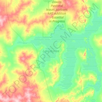
Name: Lake Barlee topographic map, elevation, terrain.
Location: Lake Barlee, Westaustralien, Australien (-29.58147 118.94362 -28.85685 119.98109)
Average elevation: 433 m
Minimum elevation: 390 m
Maximum elevation: 556 m
Other topographic maps
Click on a map to view its topography, its elevation and its terrain.
Shire Of Mingenew
Shire Of Mingenew, Westaustralien, 6522, Australien
Average elevation: 231 m
Shire Of Leonora
Shire Of Leonora, Westaustralien, Australien
Average elevation: 452 m
Boyup Brook
Australien > Westaustralien > Boyup Brook
Boyup Brook, Westaustralien, Australien
Average elevation: 225 m
Worsley
Australien > Westaustralien > Worsley
Worsley, Westaustralien, Australien
Average elevation: 244 m
Lake Argyle
Lake Argyle, Westaustralien, Australien
Average elevation: 160 m