
Eagle Peak topographic map
Interactive map
Click on the map to display elevation.
About this map
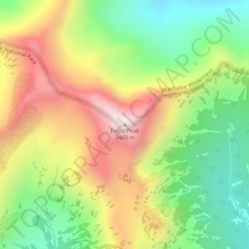
Name: Eagle Peak topographic map, elevation, terrain.
Location: Eagle Peak, Park County, Wyoming, United States (44.32013 -110.02696 44.32023 -110.02686)
Average elevation: 2,963 m
Minimum elevation: 2,571 m
Maximum elevation: 3,447 m