
Vadgaon topographic map
Interactive map
Click on the map to display elevation.
About this map
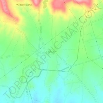
Name: Vadgaon topographic map, elevation, terrain.
Location: Vadgaon, Karvir, Kolhapur, Maharashtra, 416221, India (16.55934 74.21038 16.59934 74.25038)
Average elevation: 599 m
Minimum elevation: 551 m
Maximum elevation: 690 m
Other topographic maps
Click on a map to view its topography, its elevation and its terrain.
Rajputwadi
India > Maharashtra > Karvir
Rajputwadi, Karvir, Kolhapur, Maharashtra, 416229, India
Average elevation: 557 m