
Schiras topographic map
Interactive map
Click on the map to display elevation.
About this map
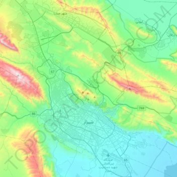
Name: Schiras topographic map, elevation, terrain.
Location: Schiras, بخش مرکزی شهرستان شیراز, شهرستان شیراز, Fars, Iran (29.52888 52.39050 29.77061 52.65201)
Average elevation: 1,749 m
Minimum elevation: 1,468 m
Maximum elevation: 2,712 m