
Sandur topographic map
Interactive map
Click on the map to display elevation.
About this map
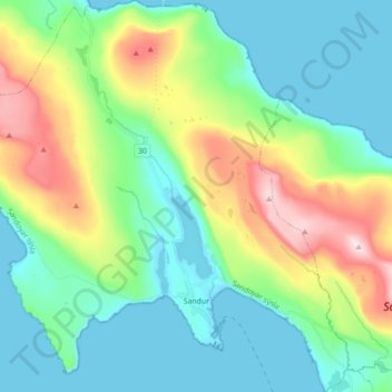
Name: Sandur topographic map, elevation, terrain.
Location: Sandur, Sandoy region, 210, Faroe Islands (61.81529 -6.92227 61.89883 -6.74832)
Average elevation: 128 m
Minimum elevation: -1 m
Maximum elevation: 466 m