
Canyonlands National Park topographic map
Interactive map
Click on the map to display elevation.
About this map
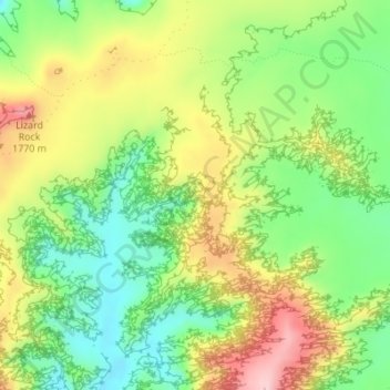
Name: Canyonlands National Park topographic map, elevation, terrain.
Location: Canyonlands National Park, Wayne County, Utah, VS (38.16660 -109.98407 38.16670 -109.98397)
Average elevation: 1,640 m
Minimum elevation: 1,548 m
Maximum elevation: 1,758 m
Other topographic maps
Click on a map to view its topography, its elevation and its terrain.
Bryce Canyon National Park
Bryce Canyon National Park, Under the Rim Trail, Garfield County, Utah, VS
Average elevation: 2,259 m
Ashley National Forest
Ashley National Forest, Duchesne County, Utah, VS
Average elevation: 2,248 m
Capitol Reef National Park
Capitol Reef National Park, Notom To Oak Creek Road, Garfield County, Utah, VS
Average elevation: 1,963 m
Fishlake National Forest
Fishlake National Forest, US Forest Service Road 1782, Garfield County, Utah, VS
Average elevation: 2,075 m