
Ypres topographic map
Interactive map
Click on the map to display elevation.
About this map
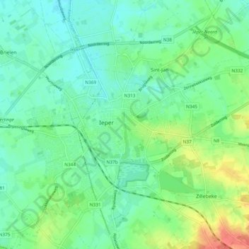
Name: Ypres topographic map, elevation, terrain.
Location: Ypres, Flandre-Occidentale, 8900, Belgique (50.82831 2.85835 50.87493 2.95238)
Average elevation: 24 m
Minimum elevation: 9 m
Maximum elevation: 60 m
Other topographic maps
Click on a map to view its topography, its elevation and its terrain.
Zillebeke
Belgique > Flandre-Occidentale > Ypres > Ypres
Zillebeke, Ypres, Flandre-Occidentale, 8902, Belgique
Average elevation: 36 m