
Adoor topographic map
Click on the map to display elevation.
About this map
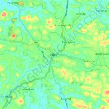
Name: Adoor topographic map, elevation, terrain.
Location: Adoor, Pathanamthitta, Kerala, 691523, India (9.11297 76.69557 9.19297 76.77557)
Average elevation: 43 m
Minimum elevation: 9 m
Maximum elevation: 123 m
Other topographic maps
Click on a map to view its topography, its elevation and its terrain.