
Make a donation
Lech topographic map
Click on the map to display elevation.
Make a donation
Lech
The altitude of 1444 m for the village refers to the location of the old church on a hill. 14.1% of the municipal area is forested, 58% of the area is Alpine. Geographically and historically, Lech belongs to the Hochtannberg region, formerly Tannberg, but in terms of tourism the municipality is part of the Arlberg region. Lech belongs to the district of Bludenz and also to the judicial district of Bludenz, but unlike its southern neighboring communities of Klösterle and Dalaas, which also belong to the district of Bludenz, it is not located in the Klostertal, but in the Arlberg massif to the northeast of it.
Make a donation
About this map
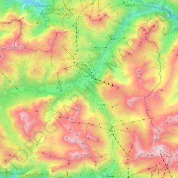
Name: Lech topographic map, elevation, terrain.
Location: Lech, Bezirk Bludenz, Vorarlberg, Austria (47.14803 10.03213 47.25166 10.21375)
Average elevation: 1,947 m
Minimum elevation: 1,164 m
Maximum elevation: 2,782 m
Make a donation