
Make a donation
Perumpallam dam topographic map
Click on the map to display elevation.
Make a donation
About this map
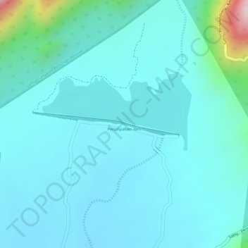
Name: Perumpallam dam topographic map, elevation, terrain.
Average elevation: 335 m
Minimum elevation: 276 m
Maximum elevation: 673 m
Make a donation
Other topographic maps
Click on a map to view its topography, its elevation and its terrain.
Satyamangalam
India > Tamil Nadu > Sathyamangalam
Sathyamangalam is situated on the southern side of the Western Ghats, which extend towards the east from the Nilgiri mountains. The general topography is not flat and covered by sloping lands. Bhavani river flows at the center of the town from west to east. Agricultural wet lands are predominant on both sides…
Average elevation: 248 m
Satyamangalam
India > Tamil Nadu > Sathyamangalam
Sathyamangalam is situated in the region between the Eastern and Western Ghats, which are separated by the Moyar River valley in Nilgiris towards the north. The general topography is not flat and covered by sloping lands. Bhavani river flows at the center of the town from west to east. Agricultural wet lands…
Average elevation: 248 m