
Garland topographic map
Interactive map
Click on the map to display elevation.
About this map
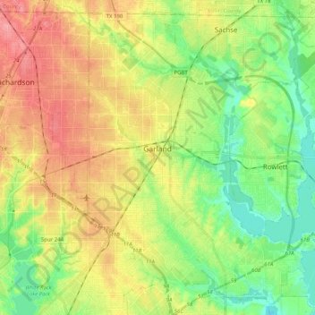
Name: Garland topographic map, elevation, terrain.
Location: Garland, Dallas County, Texas, Estados Unidos de América (32.83014 -96.70576 32.98559 -96.50552)
Average elevation: 165 m
Minimum elevation: 126 m
Maximum elevation: 213 m