
Quintana Roo topographic map
Interactive map
Click on the map to display elevation.
About this map
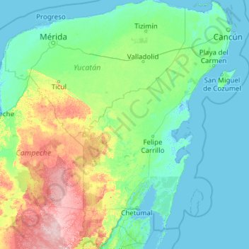
Name: Quintana Roo topographic map, elevation, terrain.
Location: Quintana Roo, Mexiko (17.89399 -89.29656 21.60550 -86.71061)
Average elevation: 41 m
Minimum elevation: -4 m
Maximum elevation: 358 m
Other topographic maps
Click on a map to view its topography, its elevation and its terrain.
Francisco Uh May
Mexiko > Quintana Roo > Francisco Uh May
Francisco Uh May, Tulum, Quintana Roo, Mexiko
Average elevation: 18 m