
Chenal topographic map
Interactive map
Click on the map to display elevation.
About this map
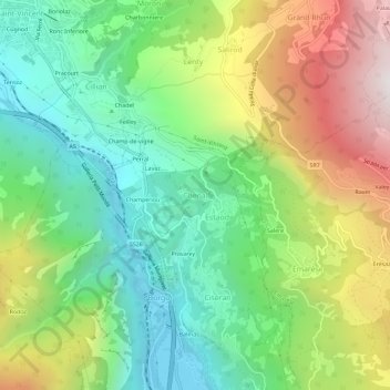
Name: Chenal topographic map, elevation, terrain.
Location: Chenal, Montjovet, Vallée d'Aoste, 11027, Italie (45.71168 7.65365 45.75168 7.69365)
Average elevation: 884 m
Minimum elevation: 379 m
Maximum elevation: 1,727 m